
What is the Glynchbook proposal?
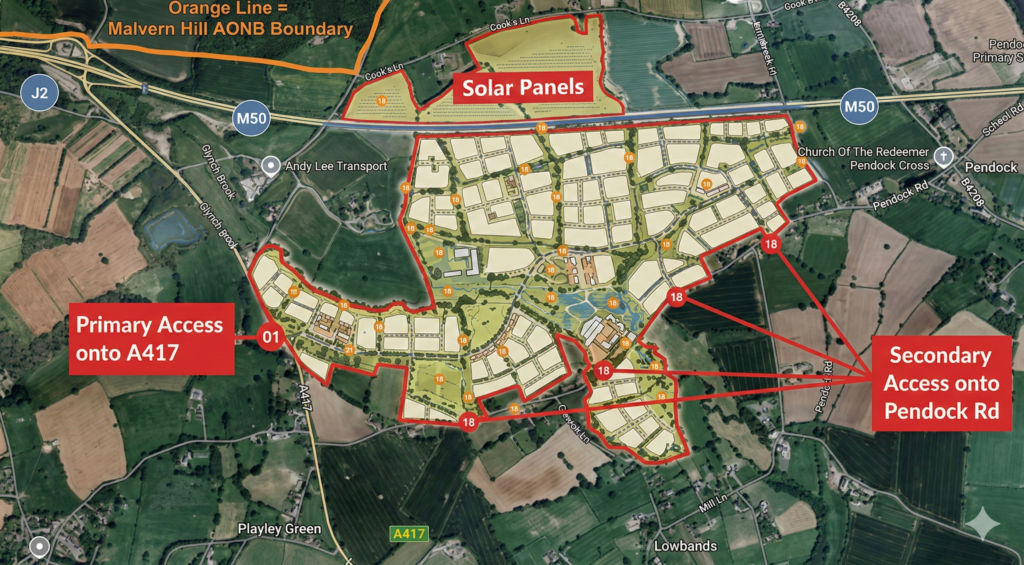
- The Glynchbrook proposal is for a 3,500-home new town which is being promoted by Black Box Planning
- According to Black Box Planning, the Glynchbrook site covers 146 hectares of high-quality agricultural land and has flood zones throughout it
- The site is located within a remote, rural area between the historic villages of Redmarley D’Abitot and Lowbands Chartist settlement, between the M50 and A147
- The site sits beneath the Malvern Hills National Landscape and at its nearest point is only 36 metres away from the National Landscape boundary
- Essential services such as railways, secondary schools, hospitals and wider employment opportunities are located in Gloucester 16.5km to the south and Ledbury 9km to the north
- The town of Malvern is located approximately 13.5km north
- The new town will not have a train line and limited bus connectivity
Why should you object to Glynchbrook?
1. Glynchbrook is isolated from everyday services
The site is a long way from jobs, schools, healthcare and public transport. There’s no rail station and only limited bus services, which means people would end up driving for most everyday things, which could contribute to around 18,000 more daily vehicle movements.
2. Climate change concerns
Due to the lack of sustainable connectivity, each of the 3,500 homes in Glynchbrook will need to have at least one car. When our climate is in crisis, this is unjustifiable, it would significantly increase harmful air pollution, and is not compliant with the national carbon-reduction commitments.
3. Alternative sites are more sustainable
Housing growth of this scale could and should be focused on places that already have rail access, services, and deliverable infrastructure, which would be more sustainable and avoid irreversible loss of valuable greenfield land and associated habitat and biodiversity loss.
4. The landscape and history of the area matter
We are so fortunate to live in a beautiful part of the world, shaped by its countryside and heritage, including the Malvern Hills National Landscape and Lowbands Chartist Settlement and Conservation Area. Once that setting is altered, and a permanent adverse visual impact is introduced to the landscape by development on this scale, it is lost forever – you can’t bring it back later.
5. Flood Risk
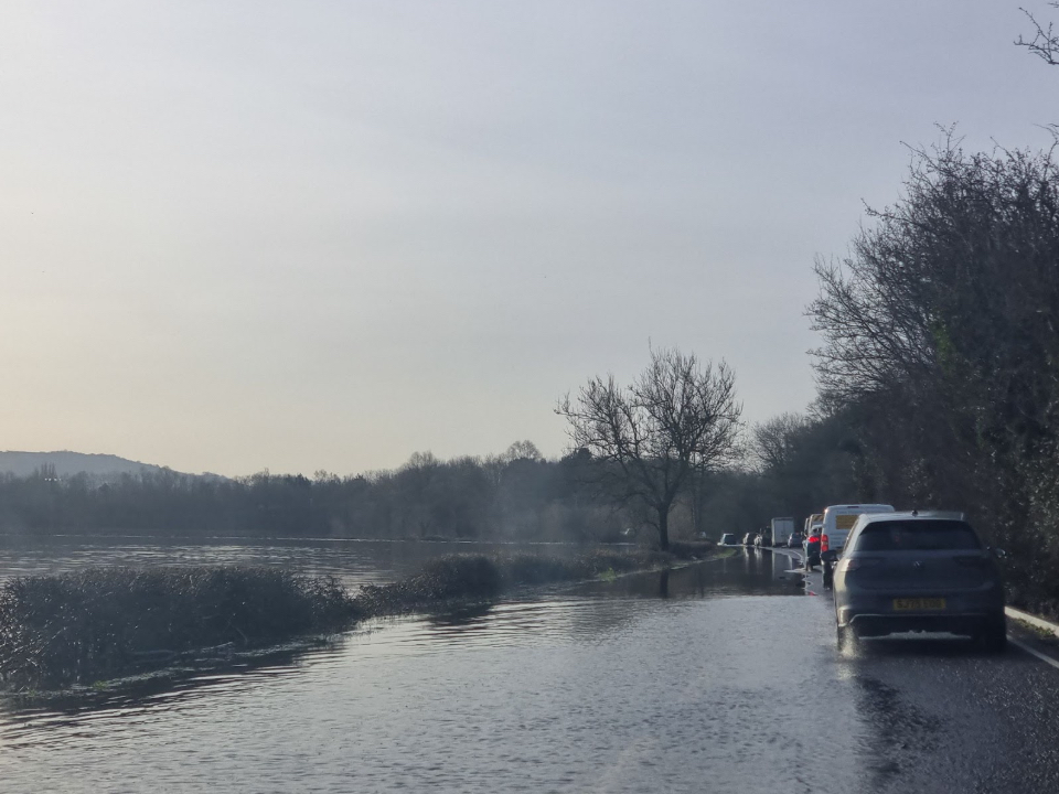
Large parts of the site are within Flood Zones 2 and 3, where National Government policy states major development should be avoided. The site floods multiple times a year – building a new town in an area known for flooding is irresponsible.

Fill in your details below and we’ll keep you updated with all the latest news about the campaign.